

📊 Full opportunity report: What Is StreetComplete? A Look At Its OpenStreetMap Quests on IdeaNavigator AI — validation score, market gap, and execution plan.

Get the latest gadgets delivered free — and shop member deals
- Fast, free delivery on millions of items
- Access to Prime Big Deal Days deals on October 6–7
- Prime Video, Amazon Music and more included
TL;DR
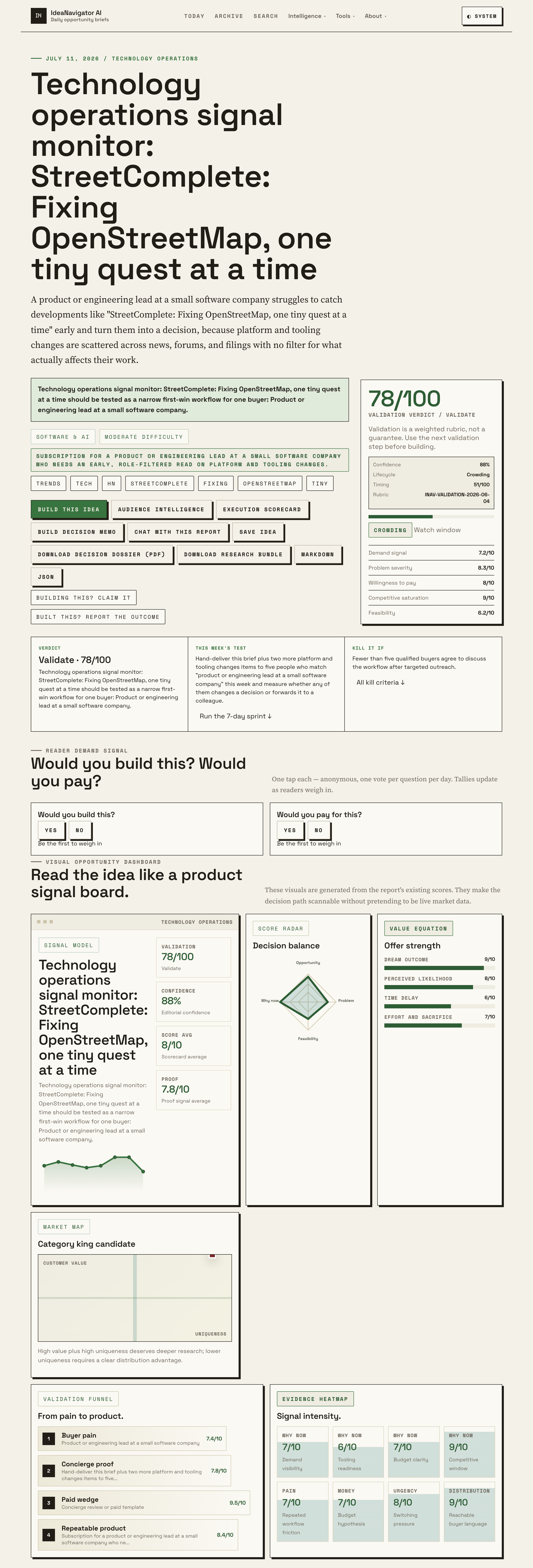
StreetComplete, a free Android app, lets volunteers improve OpenStreetMap through small, guided “quests” like adding opening hours or sidewalk data. The project recently drew renewed attention after surfacing on Hacker News with an 88/100 signal score, per IdeaNavigator AI. Its relevance extends beyond mapping to how small technical teams monitor fast-moving open-source tooling.
The Android app StreetComplete, which invites volunteers to improve OpenStreetMap through small, gamified tasks called “quests,” has drawn renewed attention after the project surfaced on Hacker News with an 88/100 signal score, according to a technology operations monitor published by IdeaNavigator AI. The app’s approach — breaking map editing into tiny, answerable questions rather than full map edits — has made it one of the more accessible entry points into crowdsourced cartography, and its visibility matters both to the OpenStreetMap community and to technical teams who track fast-moving open-source tooling.
StreetComplete is a free, open-source application that scans a user’s surroundings for missing or incomplete OpenStreetMap data and presents it as simple questions. Instead of asking users to learn OpenStreetMap’s full editing interface, the app poses targeted quests such as “What are the opening hours of this shop?”, “Does this road have a sidewalk?”, or “What surface is this path made of?” Answers are uploaded directly to OpenStreetMap, where they become part of the free, globally shared map dataset.
The significance of the model is its low barrier to entry. Traditional OpenStreetMap contribution requires familiarity with editing tools like JOSM or the web-based iD editor, plus an understanding of tagging conventions. StreetComplete removes most of that overhead by generating the underlying map changes automatically from a user’s answers, while limiting edits to a curated set of data types the app supports. According to IdeaNavigator AI’s monitoring, the project was surfaced on Hacker News with an 88/100 signal score, reflecting sustained community interest in the tool.
For the OpenStreetMap ecosystem, the app functions as a steady stream of small, verifiable data improvements. Opening hours, surface types, wheelchair accessibility, cycle lane details, and building addresses are among the kinds of attributes the app collects — data categories that are expensive to gather centrally but straightforward for someone standing at the location to confirm.
Why Tiny Map Quests Matter at Scale
OpenStreetMap underpins navigation apps, logistics routing, humanitarian response, and countless commercial map products, so the quality of its attribute data has practical downstream effects. Missing opening hours or incorrect surface tags can mean a misleading route for a wheelchair user or a wasted trip to a closed shop. StreetComplete’s quest model addresses exactly this long tail of small gaps that bulk data imports and aerial imagery cannot resolve, because it puts a human on the ground confirming details in person.
The renewed Hacker News visibility also points to a second audience: product and engineering leads at small software companies. IdeaNavigator AI’s analysis frames StreetComplete as a case study in why role-filtered monitoring of open-source tooling matters, arguing that platform and tooling changes “are scattered across news, forums, and filings with no filter for what actually affects their work.” For teams building on open data or open-source components, projects like StreetComplete illustrate both an opportunity (rich, community-maintained data) and a monitoring challenge (spotting meaningful changes early).
Top picks for "streetcomplete look openstreetmap"
As an affiliate, we earn on qualifying purchases.
StreetComplete Within OpenStreetMap’s History
: “OpenStreetMap, founded in 2004, is a collaborative project to build a free, editable map of the world. Its contributor base has historically skewed toward hobbyist mappers using desktop tools, and community discussions have long focused on how to lower the barrier to entry for newcomers. Mobile-first contribution apps emerged as one answer, with StreetComplete becoming one of the best-known examples on Android.
The “quest” framing was a deliberate design choice: rather than presenting users with an open-ended editor, the app shows a pin on the map with one specific question. This structure, its developers have argued, makes contribution feel achievable in spare moments — a few minutes waiting for a bus can resolve several quests. IdeaNavigator AI’s monitor highlighted the framing “Fixing OpenStreetMap, one tiny quest at a time” as the core of the project’s appeal.
Open Questions About Reach and Data Quality
Several things remain unclear. The 88/100 signal score comes from IdeaNavigator AI’s own monitoring methodology, and the company does not publicly detail how the score is calculated or what baseline it reflects; it should be treated as that service’s assessment rather than an independent measure. Precise current adoption figures — active users, quests resolved per month, or share of OpenStreetMap edits attributable to the app — were not included in the available material and are not stated here.
Questions also persist within the OpenStreetMap community about how quest-based edits are reviewed for quality, and how well the app’s curated question set keeps pace with evolving tagging standards. The app’s availability and feature set can change between releases, and the current version’s exact quest lineup was not specified in the source material.
Monitoring the Project and the Signal
For the OpenStreetMap community, the near-term trajectory involves the app’s ongoing development on Android, potential new quest types, and continued community debate over data quality controls. For technical teams, IdeaNavigator AI proposes a validation step: delivering short, role-filtered briefs on developments like this one to a small group of product and engineering leads and measuring whether the information changes a decision or gets forwarded to a colleague. Whether that monitoring approach gains traction, and whether StreetComplete’s renewed visibility translates into sustained new contributions, remains to be seen.
Source: IdeaNavigator AI
Key Questions
What is StreetComplete?
StreetComplete is a free, open-source Android app that lets volunteers improve OpenStreetMap by answering simple, location-based questions called quests — for example, a shop’s opening hours or a road’s surface type — without needing to learn a full map editor.
Who owns the data collected through StreetComplete?
All answers are contributed to OpenStreetMap, the free and openly licensed world map. The data is not proprietary to the app and can be used by anyone under OpenStreetMap’s open data terms.
Is StreetComplete available on iPhone?
StreetComplete is documented as an Android application. The available material does not confirm an iOS version, so iOS users should check the project’s official channels for current availability.
Why did StreetComplete attract renewed attention recently?
According to IdeaNavigator AI, the project surfaced on Hacker News with an 88/100 signal score, reflecting strong community interest. That score is the monitoring service’s own assessment; its methodology is not publicly detailed.
Can StreetComplete edits be trusted?
Quest answers are provided by volunteers on-site, which makes them often accurate for observable details. However, quality-control processes and how the app keeps pace with OpenStreetMap tagging standards are ongoing community discussions, and specifics were not detailed in the available material.
Source: IdeaNavigator AI
Fall Picks
fall essentials
As an affiliate, we earn on qualifying purchases.